


We stayed at Mammoth Mountain last night so we could take the shuttle bus to Reds Meadow and Devils Postpile to complete the remaining 48 miles of the Sierra High Route (for us). This section of the Sierra High Route ends at Tuolumne Meadows. We took the first bus leaving Mammoth to Reds Meadow at 7:30am and got started around 8:15am this morning. It is late for us but we are glad to be back on the trail. This section of the Sierra High Route from Reds Meadow starts on the Muir Trail and after a few miles turns onto the Beck Lakes Trail before heading cross country over Nancy Pass.


It begins to rain as we get to the top of Nancy Pass and get our first views of the Minarets. There is something compelling about the Minarets. They drip darkness, piercing the white flesh of the sky like daggers. I am drawn into their beauty reluctantly.


We work our way across the talus slopes towards Minaret Lake. I am very used to talus hiking now and this is nothing like the big talus going over Frozen Lake Pass or Alpine Col. My ankles have gotten really strong on this trip (I am just wearing Hoka trail running shoes after all…). It also helps to keep the pack light. I shutter to think what it would be like trying to cross these talus fields with a 50 or 60 lb pack. My pack weighs about 25 pounds, give or take, right now with 5 days of food.

We cross country to Minaret Lake and connect to the Minaret Creek Trail which is a fairly popular trail coming up from Devil’s Postpile and Red Meadows near Mammoth Lakes. We see a few people but it is not crowded. Maybe it is because it is September now and after Labor Day weekend. Or maybe the Lions Fire has scared people away from this area.

It is raining as we work our way around Minaret Lake and up towards Cecil Lake. We have been to Cecil Lake two years ago when we hiked the John Muir trail. We took a day hike from a camp at Shadow Creek and hiked past Ediza and Iceberg Lakes and up to Cecil Lake. It was one of our favorite days on our John Muir hike. We call them “scamper days” when you do a side hike without packs. We haven’t had much in the way of scamper days on the Sierra High Route. But it is a different trip.
There is not an official trail between Minaret and Cecil Lakes but enough people have hiked between the two lakes so there are some fairly defined “use” trails. Roper talks about a class 3 slot that slices through a steep cliff band below Cecil Lake. This slot does not appear to be used anymore. The “use” trail goes to the right of the slot and switchbacks up a rocky gully. It is fairly straightforward and easy to follow.

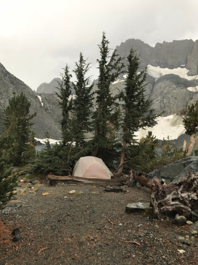
Cecil Lake down to Iceberg Lake is a “steep and unpleasant slope” as described by Roper. For us, it begins to rain hard and the rocks are very slick. We stop at Iceberg Lake for the night where it begins to hail as we put up the tent. The temperature has dropped. I guess that is to be expected at an elevation close to 10,000 feet in September. Fall is definitely here.

Video of the Day:
Hello! Very helpful article. I’m After the section of the SHR from Devil’s Post Pile to Tuolumne Meadows. I’m having trouble getting permits for Minaret Lakes Trail head. I see you mentioned Beck Lakes here… I’m wondering if i can get Beck lake trail head permits (they are more readily available right now) and still get to the SHR without replanning my entire route. Any insight on that?? I’d appreciate it !
Yes. You could get a permit for the Becks Lake TH – take it and head over Nancy’s Pass and then down to Minaret Lake and over to Iceberg. The permits should be pretty easy to get.