


The day started off a lot more mild. We decided to do a flip and do the last section of the Sierra High Route heading north out of Yosemite because of the fire by Mammoth Lakes. We parked our car at the Wilderness Parking Lot at Tuolumne Meadows and got started hiking by 6:20am. It was cold when we started, frost sparkling on the grasses, and the crisp feel of Fall in the air.

It is August 22nd after all.
We start the first five miles on the trail that goes to Gaylor Lake. From Gaylor Lake the route is all cross country for 30 miles until it ends in Mono Village. This three day section is perhaps the hardest on the Sierra High Route. It includes the passes of Mine Shaft, Sky Pilot Col, Grey Butte, Stanton and Horse Canyon. Stanton Pass is supposed to be the trickiest terrain on th High Route (Talusfield). It also ascends the east ridge of Mt Conness in what Talusfield describes as one of it’s boldest lines. It certainly ended up being bold for us…

We have given ourselves 3 1/2 days for this section. Lew Hill’s Shuttle service will pick us up around 2pm four days from now in Mono Village and take us back to our car at Tuolumne Meadows. This seems like plenty of time.
After Gaylor Lake, the trail is done and we cross the meadows heading towards Mine Shaft Pass. It is pleasant walking through the meadows weaving between glacial erratics abandoned by the glaciers as they melted and retreated 10,000 years ago.
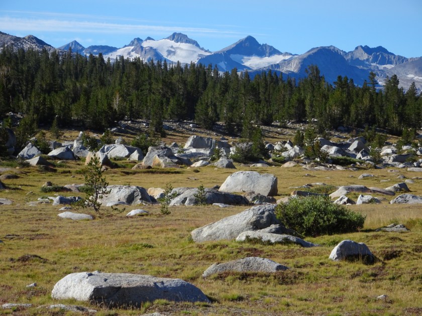
As we climb up towards Mine Shaft Pass, the geology and terrain changes dramatically. We are no longer in the smooth polished domes and cragged spires so classically associated with Yosemite. To the north is another world, dark metamorphosed rock traumatized by hot fluids and shot up by lightning bolts of white aplite dikes and quartz veins. It is here that miners from the late 1800s hunkered down and fought the cold to mine silver in the winter. Yes, in the winter. I can’t even imagine.

Now I go into hyper focus. Just get to the top becomes my only goal. I climb up the snow. Then I pass my pack up to Ray so I can chimney up a crack that is too narrow and steep with a pack on.
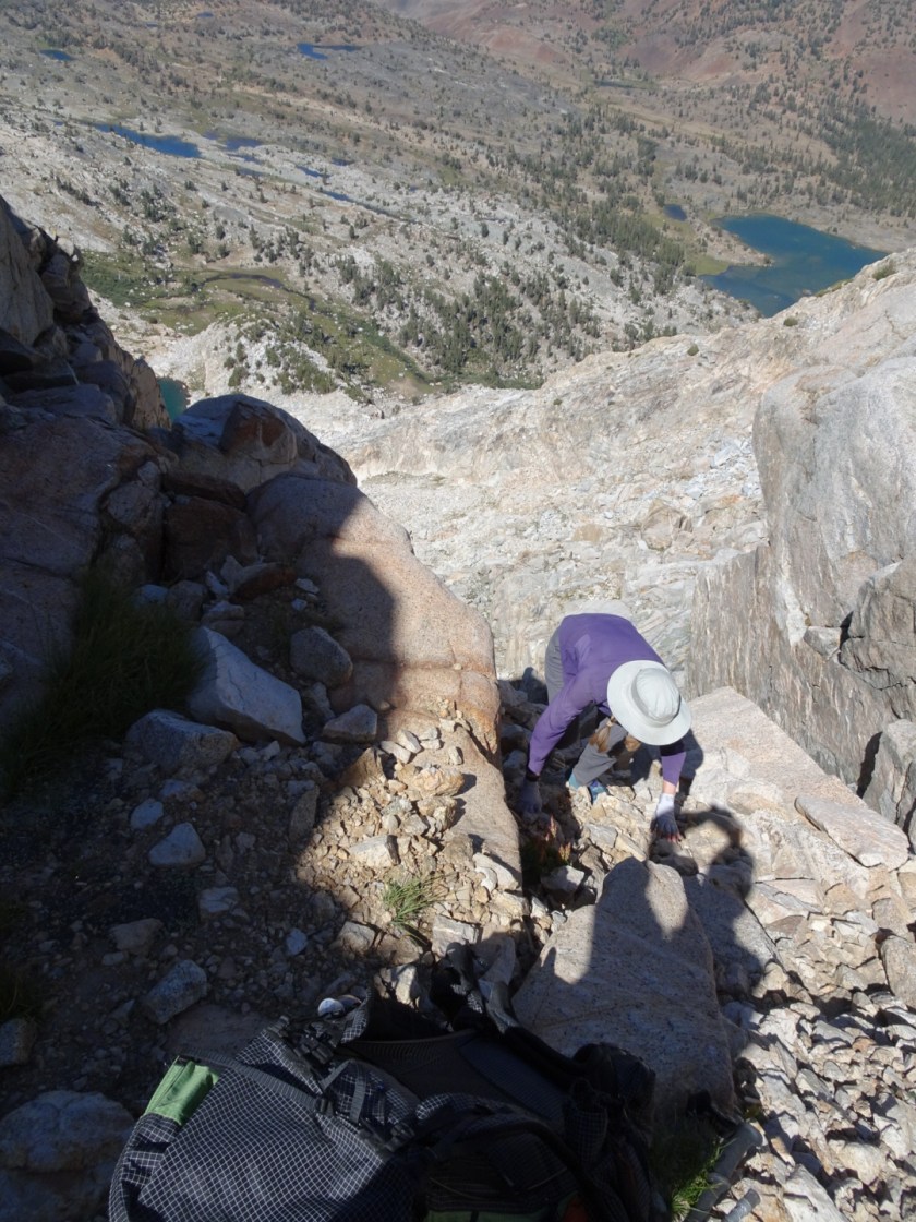
This is definitely class 4 on the Yosemite Decimal System. Class 3 is described as easy and moderate scrambling with some exposure. Some of the passes on the Sierra High Route are class 3. Class 4 is a very exposed scramble or basic climbing where a fall could be fatal and ropes are often used. But we have no ropes. Yikes.

And then we are out of the chute and up high enough we can take “the conspicuous curving spur that drops abruptly towards the lowest Conness Lake” as described by Roper. Ok, now we got it but definitely took a route too low on the slope. I breathe or more like gulp in the air knowing I am probably safe for another day.
The next few miles are a blur as we scramble our way down and around to Cascade Lake. That night I go to bed thinking about the harder passes ahead. It is so easy out here to miss a route just by a little bit. These mountains do not suffer fools.

Interesting to see the trace of your route on Mt Conness – I remember that being quite tricky terrain even on the ‘correct’ route!
Yep. A tricky area indeed! This ended up being the hardest part of our hike because of the route we chose….😬😳