

Day 18
Total Miles: 9.9
Cumulative Miles: 194.1
Elevation Gain: 663 ft
Elevation Loss: 3558 ft
Camp: Stay at cabin in Reds Meadow Resort
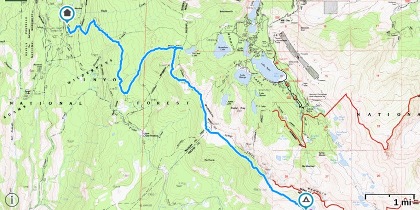
Today we are going to hike along the Mammoth Crest, drop down to Mammoth Pass, and then take the pack trail down to Reds Meadow Resort. There we will pick up our next resupply and have a zero day to clean up and get ready for the next section. Only thing is, we don’t know whether we will be able to hike the next section because of the fire. We will weigh our options when we get there.

We get started around 8am in the morning and start climbing up and along the Mammoth Crest. We still are not sure if we can get over the Mammoth Crest and down to the pack trail that leads to Reds Meadow as we don’t have the guidebook pages for this area copied on our phone. We had planned on going to Iva Bell Hot Springs and to Reds Meadow Resort from there but the fire has changed all that. Now we are navigating just by the topo lines on the map. I say to Ray, “it looks like there is a small drainage on the map which may provide a way down to the trail. The crest itself looks like it could end in a cliff”.

I guess all the experience we have both had in navigation and map reading paid off. The drainage we thought would go on the map does. In fact, there is kind of a trail up the drainage and we see a trail runner making his way up it. This area is close to Mammoth Lakes after all.

We take the pack trail and drop down into Reds Meadows. As we do it gets hotter and smokier. Both Ray and I are subdued as we ponder the fire and what it will mean for the rest of our hike.

A helicopter carrying water to fight the fire flies overhead; an ant biting the elephant I think. It is so small but maybe with enough buckets it will make a difference.

We are at Reds Meadow by 1pm which means we are in time for lunch! Yay, a big 🥘!! Oh the small pleasures when you are hiking……