

Route: The Collegiate Peak Loop is a 160-mile Loop that combines the Colorado Trail (CT) where it splits to an East and West route through the Collegiate Peaks in central Colorado. This trip report describes a six day, 104-mile section of the loop that includes all of the Collegiate West CT, and a portion of Segment 15 on the Collegiate East CT. On our trip, we averaged about 17.5 miles per day, with an average ascent and descent of around 3,000 ft each.

We started at the Angel of Shavano Campground on the Collegiate East, hiked south to the junction with Collegiate West, and then north on the Collegiate West to Twin Lakes.

Our original plan was to hike the entire loop but a personal matter changed our plans. No big deal. Ray and I have done the eastern side, or the Collegiate East twice, once when we hiked the Colorado Trail in 2017, and last summer. Last summer we had planned to hike the loop but we only had a window in early July and the snow levels on the Collegiate West side were just too high. We hiked the Collegiate East again, partly because it is beautiful and partly because we had a reservation at Mount Princeton Hot Springs. Having a soak there after hiking for days (or weeks if hiking the Colorado Trail) is truly a great pleasure.
Resources: The two best resources to plan for and use on the Collegiate Peak Loop are:
The Databook is a handy pocket guide that provides information on major features, miles between them, water sources, campsites trailheads, resupply locations, etc. It is small enough to carry with you on your backpacking trip. If you are concerned about weight, you can take pictures of the pages needed and put them on your phone. The Guthook App makes navigation on the Collegiate Peak Loop and Colorado Trail very easy. You can pull up your location on the app and see how much farther you have to go to your intended goal. It also has a social feature which allows you to communicate with other hikers and get the latest info on water sources, snow conditions, etc. The Guthook bundle for the Colorado Trail includes the Colorado Trail, the Colorado Trail Bike Route, the Collegiate West Alternate, and the Collegiate Peak Loop. Both of these resources will cost you about $20 (year 2020 prices).
Planning: Both Ray and I like to plan so we typically put together a spreadsheet with estimated miles, elevation gain/loss, campsites, resupply locations, etc. The spreadsheet for our Collegiate Peak Loop hike is located here. Note this was before we adjusted our plans to just start from Angel of Shavano Campground. We both also have an equipment list which I adjust for each hike and use as a checklist before the trip.
DAILY NEET BEAT
Day 0: We drove two cars from Durango, CO to Twin Lakes and dropped off one of our vehicles there. Then we drove to Angel of Shavano Campground where we met friends and shared dinner and stories. It was fun to visit with good friends, especially in pandemic times where social interaction is limited. We camped that night at the campground using older tents and sleeping bags so we didn’t have to unpack our backpacks.

Day 1: Angel of Shavano Campground to South Fooses Creek: 10.7 miles, 1699 ft/1034 ft elevation gain/loss, Colorado Trail Segments 14 and 15.

The morning started off great. Rob cooked us blueberry pancakes. I’m pretty sure they are the best pancakes I have ever had. Maybe it had something to do with eating them while camping or anticipating a big hike. Maybe Rob is just a phenomenal cook. I don’t know but damn they were good.

Ray and I drop off the vehicle at the Angel of Shavano Trailhead and start south towards US50 around 8:15am. We plan on only hiking 10.5 miles today and stopping along Fooses Creek before climbing up to the Continental Divide. After Fooses Creek, there is a long 17–mile dry stretch with the only water being at the water station inside the souvenir shop on US50 at Monarch Pass. Because of the Pandemic, we don’t want to stop in a souvenir shop where there may be high exposure to other people. We want to stop at water tonight and fill up before the long dry stretch.

Hence a shorter day of only 10.5 miles. Or maybe I was trying to justify why we could take our time and eat pancakes. Either way, we feel like we have plenty of time and don’t rush the day.
By late morning we have hiked over 5 miles and cross US50.

We start up the road that leads to Fooses Creek Trailhead. As we walk up the dirt road toward the Fooses Creek Trailhead, Ray and I both reflect on how rusty we feel to have a pack on our backs. We were comfortably hiking over 20 miles on our thru hikes and even hiked over 30 miles one day on the Hayduke Trail. But my pack feels heavy with seven days of food, even though it only weighs 31 pounds. It is probably good we started with a short day I say to Ray. I feel like I am in trail running shape but it is different with a pack on your back.
We stop at the Fooses Lake Trailhead and spend about an hour speaking with Mike who has hiked the CDT, PCT and the Colorado Trail. He and his wife are hiking segments of the Colorado Trail in opposite directions, and meeting at night to camp in their camper van. I like that approach, and Ray and I both admire his van. It is nice to meet kindred spirits on the trail.

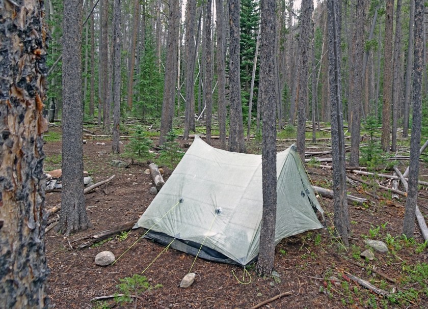
We are at camp before 2pm and find a spot in the trees by Fooses Creek. It starts to rain so we jump in the tent for a while. The wind picks up which causes me some concern. The trees here are Lodgepole pines. Lodgepole pines are tall and thin and can blow down easily in a windstorm as they do not have deep roots. Hopefully we will be ok.
Day 2: South Fooses Creek to Hunt Lake: 18.6 miles, 3733 ft/2032 ft elevation gain/loss, Colorado Trail Segment 15 and Collegiate West 5

The rain stopped last night and the wind died down. It is clear and beautiful this morning. We have been on this trail before and know that we are starting off with a steep climb up to the Continental Divide. Up we go over 500 feet in 0.4 miles. Although I breathe a little harder as we get up around 12,000 feet, I feel that the trail running has at least kept my cardio-endurance up and it is not too difficult.

Then we are on the Continental Divide and go into cruise-mode as the trail is fairly flat above tree line for the 5 miles between the Fooses Creek Trail and Monarch Pass. Now we are headed north along the West Collegiate trail. The views are spectacular but in short order we begin stepping off the trail as mountain bike after mountain bike flies by us.


Oh yeah. It is a Friday morning and we are on one of the most popular mountain bike rides in the state of Colorado. Mountain Bikers come from Denver and park at Monarch Pass. It is an easy 11.5 miles to Marshall Pass and it is above tree line with great views. We are near the beginning of the ride at Monarch Pass during a popular time of year and are experiencing the Friday morning crowd meandering across the grassy slope. I begin to count the mountain bikes passing us: 1,2,3…10..40. When we get to less than a 1/2 mile from Monarch Pass we are above 100 mountain bikers that passed us.

I am no longer at ease as I am jumping off the trail every few minutes. Hikers have the right-of-way but mountain bikers have the momentum and most expect us to get off the trail.
When we finally get to Monarch Pass where US50 crosses the continental divide, we have counted 120 mountain bikes that passed us headed south.

I remember why I have a love-hate relationship with the Colorado Trail. On one hand, I really appreciate the acceptance of different uses and how courteous most people are. There are many ways to enjoy the outdoors and Coloradans embrace them all. It feels open and free, in a way. Everyone is respectful: “thank you”, “have a good day”, “One more coming”. On the other hand, my experience today is not one of enjoying the peace and quiet of the mountains. I am on edge waiting for the next mountain bike so that I can jump off the trail. I tell myself to never again be hiking on a popular mountain bike trail on a Friday or weekend morning!

Once we cross the highway at Monarch Pass, we move into a different world. It is quiet and peaceful once again as we wind around the top of the Monarch Mountain ski area and head north.

After an hour or so, we pass the Monarch Pass Game Drive. The game drive is at a grassy pass and was used in prehistoric times by hunters. I am beyond amazed at how our ancestors created these traps for elk and/or bighorn. They essentially planted flags along these small boulder walls. Women and children would scour the woods scaring the animals up towards the grassy pass at 11,700 ft. The animals would run parallel to the walls with fluttering flags made of animal skin (sewels) and be driven into ambush sites where warriors would be waiting with bows and arrows. The game drive was used from 3,000 BC to 1800 AD, or close to 5,000 years. What ingenuity! If you want to know more, read here

The rest of the afternoon we are above tree line until we drop down to Hunt Lake. It clouds up but we don’t hear any lightening or thunder so we keep moving. I forget how cold it can be up around 12,000 feet.

We drop down into the trees at Hunt Lake where we set up camp. We made it 18.6 miles on 2 liters of water each and are glad to reach water at Hunt Lake. Our water source at camp is coming out of a rock glacier that feeds the lake. The ice that is melting from beneath the rock could be 20,000 years old. It is like a fine wine, aged and crisp in it’s deliciousness. I appreciate it more because we have gone most of the day without water. Time to drink up!

Day 3: Hunt Lake to North Fork Chalk Creek: 18.6 miles, 3096 ft/3492 ft elevation gain/loss, Colorado Trail, Collegiate West 4 and 5.

Today we will pass by many water sources, but camping areas are more limited. Therefore, we plan on hiking all of Collegiate West Segment 4 and camping near the North Fork of Chalk Creek. This means we have over 18 miles of hiking today. I kind of feel rusty and new, different then when we have done our other hikes where we have been hiking for 30-60 days. It doesn’t feel routine yet.

Ray and I start to get into our usual pattern of breaking down camp and are on our way by 6:20am. It is important to get hiking done in the morning in the Colorado mountains as thunderstorms with lightning, hail and wind usually build up in the afternoon. It can be dangerous when you get above tree line and are exposed to lightning without any cover. Besides, Ray and I like to get up and go. The morning, it’s coolness and moisture, are so welcoming on hot days in the summer.

We pass by Boss Lake and begin the gradual ascent along the Middle Fork of the Arkansas River and wind our way up towards Chalk Creek Pass. We pass a large talus deposit. It looks like it has had many active rock slide events with a pile that drops over 3,000 feet off of Mount Aetna. It is something to behold!

It is still sunny when we reach Chalk Creek Pass mid morning. The climb up was gentle but we still have at least another 10 miles down and 1000 feet before our next climb up.

We begin hiking down to Hancock Lake Trailhead and then take the steep 4WD road down to the Alpine Tunnel Trail. The Alpine Tunnel Trail follows the old Denver, South Park, and Pacific railroad tracks built in 1879. The history of this narrow gauge railroad and Alpine Tunnel is really fascinating (read here)

This is a popular trail. The trail has a gentle up grade suitable for children because it follows the old railroad. We see many families near the beginning of this trail enjoying the wildflowers on a Sunday.

After several miles of following the gentle railroad upgrade, we turn off the tracks and switchback up to the ridge above Tunnel Lake at 12,326 feet. It starts to cloud up but luckily nothing turns into big thunder boomers.

And then it is a cruise downhill for several miles to a campsite in the trees by Chalk Creek. 18.6 miles again today. I feel myself start to get into the rhythm of the trail.

Day 4: North Fork Chalk Creek to Headwaters of South Texas Creek: 17.9 miles, 4196 ft/3325 ft elevation gain/loss, Colorado Trail, Collegiate West 3

“Consider traveling this entire segment in one day because camping options are mostly off trail and downhill” – The Colorado Trail Databook.

Ok, so we decide we will follow this advice. Collegiate West Segment 3 is 15.9 miles and most of it above 12,000 feet in elevation. Apparently there is limited camping so we will push on to get through it in one day. So of course we start early (do we ever not??).

I feel pretty good and strong this morning. That’s a good thing as we climb up over 1800 feet in the first few miles. It’s always nice to climb when it is cool in the morning. I finally feel like I am getting my hiking legs back.

Once we get above 12,000 feet in the first few miles, we pretty much stay there the rest of the day with some undulations of 500 to 700 feet. It is gorgeous country with a complex geologic history. Ray and I stop a number of times to arm-wave about the geology. Or sometimes we stop to look at pikas, flowers, or birds. You get the picture. We are either making time or being curious kids. One hour we are hiking 3 to 4 miles per hour. The next hour we are on our hands and knees crawling around.


By mid-day we have reached Sanford Saddle and the continental divide at 12,750 feet. The clouds have moved in and we are being pelted with hail. Of course this happens when we are at the highest elevation and exposed the most! We throw our raincoats on and keep moving. It is always a tough question of whether to stop and take shelter or power through. Since we don’t hear any thunder we power through.

The rest of the day is hit or miss with the weather as it stays cloudy with partial clearing on and off. We pass by a picture perfect rock glacier at the head of Sanford Creek and marvel at the blueness and beauty of Lost Lake.

Lost Lake is one of the few areas mentioned for camping in this segment but it requires a diversion off the trail for 0.3 miles and a drop in elevation of 700 feet. We decide we don’t want to lose that much elevation and forego staying there.

The Colorado Trail Databook mentions a lake 0.1 mile west of Cottonwood Pass at the end of Collegiate West Segment 3 and we ponder this possibility for camping. Luckily, we speak with a hiker headed southbound who tells us it is very noisy and not to camp there.
This advice turns out to be right on the mark. The end of Collegiate West Segment 3 (beginning for south bounders) for us is at County Road 306 and Cottonwood Pass which today is busy with people headed to Taylor Reservoir. Where we were going to camp is very noisy with the cars traveling on County Road 306. We cross the road and head over the next ridge into the upper drainage of Texas Creek. The hiker we spoke to also told us there was good camping here. We find an excellent site away from the cars and noise and enjoy a peaceful evening.


Day 5: Headwaters of South Texas Creek to Lake Ann: 17.0 miles, 3208 ft/3377 ft elevation gain/loss, Colorado Trail, Collegiate West 2

We adjust our plans a bit as we are ahead of schedule. I estimated a average of 15 miles per day for us with an elevation gain of 3,000 feet. We have hiked on average 18 miles per day in the last 3 days. Today our main goal will be to get over Lake Ann Pass. It is one of the two major passes on the West Collegiate alternative. The other big pass is Hope Pass which we will aim to get over tomorrow.

Our camp last night was just over 12,000 feet so first we will drop down for five miles to Texas Creek at an elevation just over 10,000 feet. We will hike through the forest and eventually work our way back up into the alpine tundra and cross Lake Ann Pass at 12,588 feet. There is good camping at Lake Ann just over the pass and down about 800 feet. Of course, the risk is that we are going over the pass in the afternoon which heightens our chance of getting caught in a thunderstorm.

It is just getting light out and we have only been hiking about five minutes when I look up to see a tall guy with a two-foot long beard and a women with braids. “I know you!” I exclaim. It is Beardoh and Sweetpea. True legends in the thru hiker world, they have spent the last nine years hiking all the major thru hikes in the US (see long distance hiker). I am a little star struck. It is like meeting a famous rock star in my world. We met them on the Colorado Trail three years ago and they were one of the first to hike the Mogollon Rim Trail. Ray and I had planned to hike the Mogollon Rim Trail this past spring until the pandemic hit.

After a few minutes of catching up, we are on our way. Soon we are at Texas Creek and down in the Forest. It feels humid today and we cross Texas Creek without incident.

Most of the day I am pre-occupied. My brother is dealing with a health crisis and we will find out today how serious it is. I am glad to have a Garmin mini Inreach so we can touch base.
We start winding up through the different ecosystems on our way to Lake Ann Pass at 12,588 feet. For seven miles outside of the Collegiate Peaks wilderness boundary we share the path with motor bikes. Four of them pass by us. They are courteous but the bikes are loud and it impacts our experience. Maybe there is some way the uses can be managed better or separately. Or maybe some day, motor bikes will be electric and quiet.

By mid-afternoon we have climbed over 3,000 feet and reach the top of Lake Ann Pass. The views are beyond outstanding and we are lucky the weather has stayed sunny or partly cloudy. Well, we made our goal for the day. Now it is just a simple 1/2 mile and 800 feet down to the lake. It is great to be alive!


Day 6: Lake Ann to Twin Lake: 21.6 miles, 3127 ft/5450 ft elevation gain/loss, Colorado Trail, Collegiate West 1 and 2

I am squatted with my arms around my knees, my head against my knee caps as the crack of thunder reverberates down the valley and echoes through my ear drums. Ray and I ran for this patch of trees right at tree line a few minutes ago. We are now getting pelted with marbles of hail as the temperature drops and the wind pushes the clouds towards us.

The thunder and lightning happen at the same time, not a second between them and the air feels electrified as the storm rages above us. The rumble from the thunder seems to roll down the valley as I hear it echo for about 2 minutes.
We are about a 1/2 mile down from the top of Hope Pass just under 12,000 in elevation. As is always the case, the concern is being above tree line and being hit by lightning. Above tree line in the Rockies, lightning density is high and it is a true hazard to be there during a thunderstorm. We thought today would be good day to climb over Hope Pass. We were lucky the last few days being above 12,000 feet elevation for long stretches and not getting caught. Today our luck ran out.

It started off clear as we left camp at Lake Ann at an elevation of over 11,700 feet and began our downward descent to close to 10,000 feet. I always thought the Collegiate East alternative had the big up and downs but the Collegiate West has it’s fair sure too. As we pass down into the more forested area we begin to see more hikers. We are passing through County Road 390 and trailhead access to several 14ers including Mt Huron and La Plata Peak.

We descend 1700 feet and have hiked 9 miles by late morning. We intend to get over Hope Pass today which is at 12,548 feet, well above tree line. The sooner we can get there the better as thunderstorms typically occur in the afternoon. It is hot and humid as we start back up towards Hope Pass. It is steep and goes up over 2600 feet in 2.5 miles.

I am dripping with sweat as we begin the grunt uphill. My legs are getting stronger now but I notice some dark threatening clouds above the mountains. When did those appear I think to myself.

And then just as we are getting to tree line, “boom!”. “Time to take cover” I yell to Ray as the down drafts of cool air seem to feed on the cracks of thunder. Ray and I run for the trees, curl up into balls in the “lightning position” and huddle there as the hail and thunder rip around us.

We are there for a while. The temperature drops and my raincoat starts to soak through as we continue to be pelted by hail and rain. I begin to wonder if I should be more worried about hypothermia as I start to shiver. I grab a tortilla and gnaw on it. Ray seems to be ok as far as warmth which is a little surprising as he tends to get colder than I.
Soon the thunder and rain let up but it is still cloudy. Is it ok to make a run for the pass? Ray and I discuss it. Ray says “well, if we go, we have to go quick and get over the pass and back down in the trees as quick as possible.” I think to myself, yeah I can but it is hard at elevation and we still have about 600 feet and a 1/2 mile up.

We see a patch of blue sky and decide to go for the pass. Ray gets going. He can move quickly and is light on his feet. I feel tired but it is amazing what adrenaline can do. I just tell myself, if you stop, you might get caught. I float on my adrenaline and am at the pass in no time.

Hope Pass is a famous pass in Colorado. It is the crux of the Leadville Trail 100 foot race and runners climb it twice. The views are spectacular and there is a large cairn with sticks and prayer flags. I wonder about the prayer flags. Prayer flags bless the surroundings and promote peace, compassion and strength. Later I read that it is there for the runners to give them strength to finish the race. Maybe they gave me the strength to get here I think.

Ray and I can see Twin Lakes off in the distance where our camper awaits. We hadn’t planned on finishing until tomorrow but we are only nine miles away and it is all downhill. Yeah we can do this. We look at each other and off we go.


Sounds like another great adventure…I hope to do it next year! Let’s get together to catch up
You would ❤️it! Yes for catching up!