


“What were they hunting, lizards?” I look in awe at the delicate, tiny arrowhead, smaller than Ray’s fingertip and shaped like a pointed white fang.

Today is our 35th day out on the Hayduke Trail and this is my kind of hiking: no trail, route finding and signs of ancient use.

Our goal today is to hike from Swamp Point and make it as close as possible to an old cowboy trail in Crazy Jug Canyon. There is a trail from Swamp Point, where we start, to the Muav Saddle (beginning of the North Bass Trail) but after that it is a very hard bushwhack in Saddle Canyon. Once we get to the old cowboy trail after bushwhacking along the Esplanade Sandstone, the old cowboy trail will take us up through the Coconino Sandstone and to our car which is parked at Crazy Jug Point.
Bushwhacking across the Esplanade Sandstone is near and dear to me. The Esplanade Sandstone is the youngest and uppermost formation of the four formations in the Supai Group of the Grand Canyon. It is a ledge and cliff-forming sandstone 225 to 300 feet thick and is Early Permian in age, about 315 million years old.

Ray and I have hiked on the Esplanade Plateau many times in the western part of the Grand Canyon, between Toroweap and Kanab Creek. But we are farther east here. We are between Swamp Point and Crazy Jug Point below the rim, about 35 miles northwest of the North Rim and North Kaibab Trail.

I marvel at how similar and how different the Esplanade is here compared to near Toroweap out west. It is an important bench former and plateau in both places but here it is about 2,000 feet higher at an elevation of 6,000 feet vs around 4,000 feet elevation at Toroweap Point.

That means more manzanita bushes which has made the bushwhacking, or off-trail hiking intense. By intense, I mean the manzanita bush doesn’t give, bruises your legs, and almost punctures your shoes when you walk through it.

But the Esplanade Sandstone here is similar to out west in many ways. We have been finding signs of ancient use in this area all morning as we have on other Esplanade hikes. The tiny thumb-sized arrowhead is the third projectile point we have seen today, we found a piece of worked obsidian earlier today, and a large piece of grey ware.


And then there are the roasting pits. I am fascinated by the roasting pits we have seen on the Esplanade Plateau and we see three of them today. Donut-shaped with a ring of fire-burnt Kaibab limestone rocks, the roasting pits we see today are about 20 to 25 feet across. Foods were placed in these roasting pits on heated rocks and then were covered with grasses or other vegetative matter and soil.

The oldest dated evidence for an agave roasting pit in the Grand Canyon is 1460 to 1410 BC when small game hunters and plant gatherers from the Late Archaic were in the Canyon (see https://www.nps.gov/grca/learn/nature/cynsk-v26.htm) I wonder how old these pits are and whether they were used to roast agave plants? Or maybe lizards as well? I try to imagine using a tiny arrowhead and spearing a lizard. We just don’t have that speed or hand-to-eye coordination anymore. At least, I don’t.

I am blown away by the beauty and water we see at most of the canyon heads.

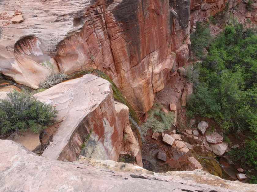
When I get real excited I forget to breath out. Between the waterfalls, projectile points, roasting pits, geology, incredible views and just the beauty of the area I stop breathing almost entirely. I forget about punctured legs, getting whacked in the face and the fact that there is no trail. This is my favorite day so far.
Wow, incredible! Gorgeous photos too. What an amazing trip!
–Karen
This looks fantastic! Tish