Map of Day 13 starting at car, hiking up through Rock Canyon, Fiddler Butte Wilderness Study Area and down Fiddler Cove into Dirty Devil River
Today started off on a road but ended up with a lot of route finding and cross country hiking. We are starting Section 4 which starts at Hite Crossing and then goes across the Red Benches to the Dirty Devil River.
The Arch Bridge over the Colorado River at Hite Crossing where this section starts
The Dirty Devil River is an 80-mile long river that has 2,000 feet canyon walls and a number of beautiful tributary canyons.
The Dirty Devil River
It was used by Butch Cassidy and his Wild Bunch to hide from law enforcement during the late 1800s. It still is one of the most remote areas in the western USA.
After crossing and heading up the Dirty Devil river for about 6 miles, we will exist out Poison Springs road which traverses west for 16 miles toward the Henry Mountains. We have given ourselves three days to complete this section.
I think about route finding and how much it has changed. When we ran into the ultra runner on day 4 who had hiked part of the Hayduke, she mentioned that she hadn’t found the route finding to be has hard as it has been stated. But times have changed. When the Hayduke Trail was put together in 2005, route finding off trail involved reading a topo map and knowing how to locate yourself by figuring out what the lines meant on the map. Ray and I have done a lot of this in the past. It took time, first to orient your compass, and then to read wavy squiggles on the map and translate them into drainages and distinct mountain features. And place yourself on the map based on compass direction and recognizing the features around you on the map.
Today we just pull out our gps app, locate the route we want to be on and walk it. So we covered 19.2 miles today mostly off trail. We easily find the two cruxes today which are a 40-foot crack climb out of rock canyon and a very steep talus slope that is the only way into the steep-walled Fiddler Cove Canyon.
We get started late this morning around 9:30am. The weather finally feels a little warmer as we are lower in elevation and will be for the next several days. The first part of the day we cross the bridge at Hite Crossing and take a dirt road that heads up Rock Canyon.
Heading up Rock Canyon along a dirt road
Rock Canyon is probably how you would picture it, a broad open valley with red rock canyon walls that narrows as you hike up canyon. Several cars stop and offer us water or anything else we may need. I always appreciate the kindness of others. One women in a pick up who stops says she picked up 2 hitchhikers on the road who were also doing the Hayduke Trail. People are always so surprised to hear we are doing the Hayduke. I can kind of read their minds: but wait that is for young badass hikers and you don’t fit that mold.
Hiking in Rock Canyon after leaving the road
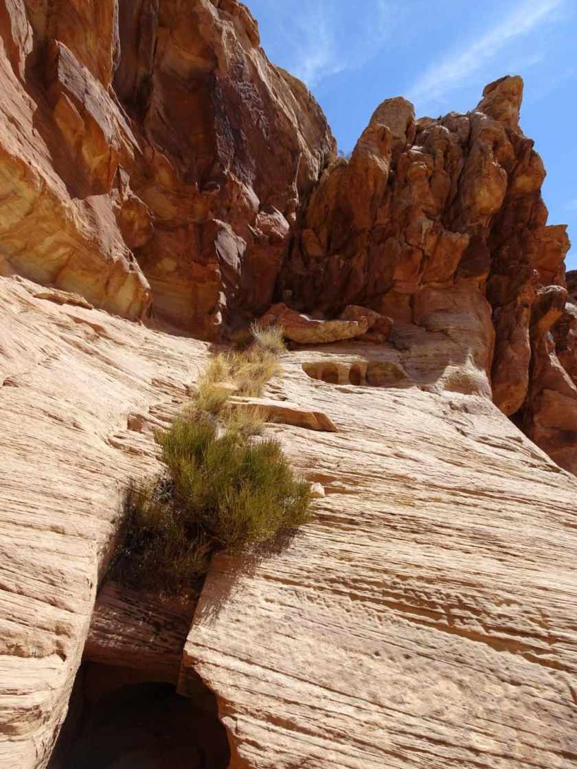
We leave the dirt road after four miles and start heading directly up Rock Canyon. We are headed for a crack exit that turns out to be a little harder than we expected. It is about a 40-foot crack that steps up through a wall that narrows and turns enough it requires taking the packs off and hauling them up with a rope.
The Red Ledge (or “crack”) that is the only way to get up above Rock Canyon onto the Red Benches
Luckily we have done enough canyon hiking and are prepared for this. Still it did have a little exposure which always makes things exciting.
Ray hauling his pack up the Red Ledge. It is too narrow to climb up this crack with a pack on.
After climbing through the crack we are on the “Red Benches” which is an open area and easy hiking though the wind is blowing pretty hard.
Ray hiking across the Red Benches
We hike cross country across the benches for about 7 miles than hit the other crux of this day which is finding the only way down into Fiddler Cove Canyon.
A cairn marking the only way into the steep-walled and beautiful Fiddler Cove Canyon
Coming down the talus slope into Fiddler Cove Canyon. I am in the middle of the picture for scale.
After a few mile hike through Fiddler Cove Canyon we reach the Dirty Devil river and set up camp. Time to call it a day.
Rock promontory in Fiddler Cove CanyonOur campsite on the Dirty Devil River


So there wasn’t a fiddler there?! Sheesh.
No fiddler or purple plastic trombones….I do wonder why it was named that….