

The Daily Neat Beat

The Hayduke “Trail” (or more acccurately described as a route) begins on the north side of Arches National Park in a broad open valley with sagebrush that is upheld on two sides by rock walls. I chuckle to myself as we get ready to begin the hike. It is already so different than the last two thru hikes we’ve done. Two summers ago when we started the John Muir Trail in California, my family flew out from Illinois, Michigan and Ohio to see us off. In the busy and hot Yosemite Valley they gave us a great send off. Even clapping for us as we started down the trail. Then last summer we had several good friends get up bright and early to see us off in Denver, Colorado as we made our way in the dawn down the spine of the Rockies on the Colorado Trail.


On top of a send off party that is is busy chewing it’s cud instead of cheering us on, there is no sign to mark the beginning of the trail or any part of the trail for that matter. You see, the Hayduke Trail is a parch work of mostly off-trail routes that wind around through Arches, Canyonlands, Capital Reef, Bryce Canyon, Grand Canyon and Zion National Parks. It’s path does not go straight or seem to have any goal.

It winds around through canyons and mesas for 800 miles. We expect it to take us about 2 months to hike with an extra 13 days to shuttle vehicles between sections. Unlike the John Muir Trail or the Colorado Trail, we don’t expect to have trail buddies. About 3,000 people per year hike the John Muir Trail, about 400 people per year hike the Colorado Trail and only a few dozen per year hike the Hayduke Trail. And, those several dozen are split between Spring and Fall. It’s a lonely ride.

We hike up the ridge towards the Dark Angel. Dark Angel is a distinctive spire on the horizon and it boldly pierces the landscape as if to lead the arches behind it on the ridge in a parade. As we work our way up through the ledges towards the Dark Angel it feels like we are alone out here. But that changes as soon as we get close to Dark Angel.

We spot a petroglyph panel that we didn’t know was here and we take a break as we ponder their meaning. These petroglyphs had a lot of figures with horns on their heads. A very interesting panel.

The Dark Angel is at the end of the Primitive Loop Trail which begins at the Devil’s Garden Trail Trailhead. It is a popular 2.34 mile hike and we soon join the crowds as we head toward the Devil Garden Campground where we have a reserved campsite for the night. On the way down we see a few of the arches which are incredible to see in person.


People look at us a little funny as we have backpacks and this is a day hike trail where some are wearing shorts and samples and nothing else. I tell one guy who asks why we have such big packs that we are hiking the Hayduke Trail. He gives me a blank stare and then says he had Coronal Arch all to himself for an hour and a half and asks me if I have seen all the arches. There is some irony here and I have to chuckle to myself. We arrive early at the campground where we are happy to have water we don’t have to filter and a picnic table! Luxuries the first day out.


We also take a quick detour to see Sand Dune Arch. It is quiet as it is still too early for people to be out hiking around the arches.

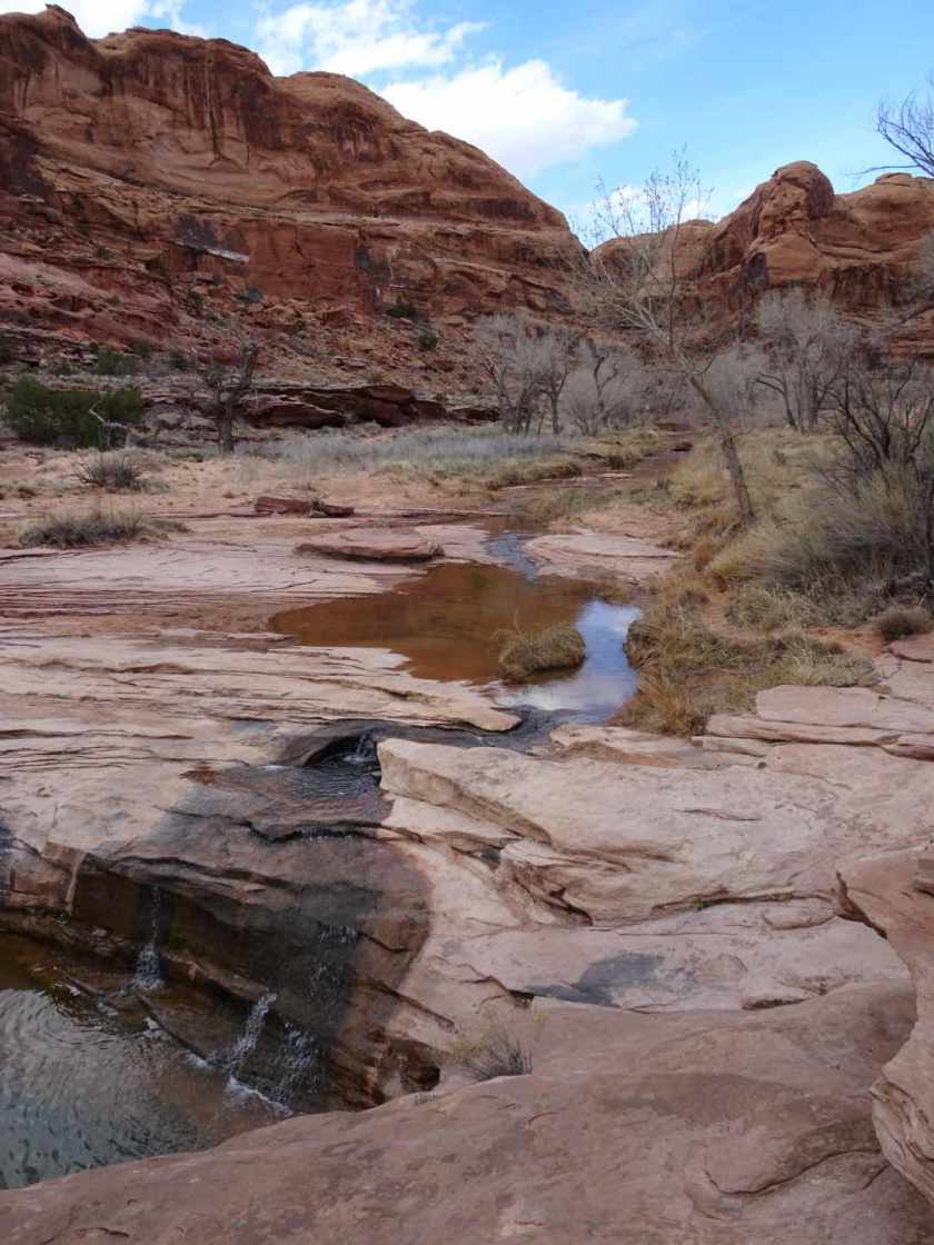
After visiting Sand Dune Arch we head to the pipeline where we will follow it across the valley, cut cross country to a gpx route from Nic Barth where we will drop into the lower half of Courthouse Wash and hike out to Moab.

After walking the pipeline to the fence line, we take a bearing and head cross country to a route that drops down into Courthouse Wash. Most of the routes we are using are from Nic Barth, a geologist who has made his Hayduke gpx files available on his website. We are using the Gaia App on the phone and as a backup hard copy topo maps with route information from Andrew Skurka.
As we have always used the bovine population or as we affectionately refer to them “les moos” as our trip delineators….being the only apparent wild life on the Euro-continent and the most common friend of the field here, we consider your send off a tremendous sign of good luck! Happy travels my friends.
Thank you Jill,